Author: Motomaro Shirao
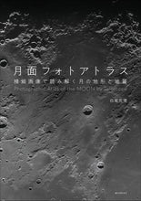
Enjoy the beautiful moon and the dynamic lunar terrain through photographs and learn about the moon!
When observing the moon floating in the night sky, several patterns can be seen on the surface of the moon. These patterns are topographical features such as craters, seas, hills, and domes, but with an astronomical telescope, it is possible to observe the topography in even greater detail. In recent years, there has been a flurry of lunar exploration plans, including the landing of JAXA's Small Lunar Landing Demonstration Vehicle (SLIM) and the lunar exploration plan "Project Artemis" to land humans on the moon, and interest in the lunar surface is growing more and more in the future.
Meanwhile, the quality of lunar photos taken by astronomy enthusiasts has improved thanks to improvements in image processing technology, allowing them to take more detailed and beautiful photos. By using a large-aperture telescope to take close-up photos of the moon, it is now possible to obtain images that rival those taken by lunar exploration satellites of the past.
This book provides detailed explanations of the lunar topography captured in detailed images of the lunar surface taken by Motomasa Shirao, a leading lunar photographer. The author, Mr. Shirao, cooperated in the photography planning for the terrain camera and HV TV camera of JAXA's lunar exploration satellite Kaguya (SLENE) project from 1995 to 2010.
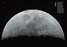
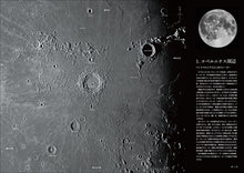
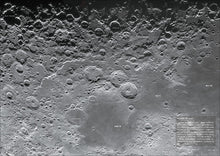
This book divides the moon's near side into areas according to the age of the moon, and shows the locations of lunar landforms (craters, mountain ranges, valleys, etc.) so that it is easy to understand when observing the moon through binoculars or an astronomical telescope. You can enjoy the place names and topographical descriptions. Particularly noteworthy landforms are introduced in the "Place Name Explanation" section along with the page where they are found.
This book is a commentary written by a single author, featuring photographs and written about the lunar topography and geology from the perspectives of astronomy and earth science. Through this book, you can "enjoy the beauty of the moon and its lunar topography, and learn more about the moon."
■Table of ContentsRegional Lunar Guide Index MAP / How to read the names of places on the moon / Equipment for viewing the moon
[Lunar guide by age]
Age 3, Age 4, Age 5, Age 6, First Quarter, First Quarter (Color), Age 10, Age 11, Age 12, Age 13, Full Moon, Full Moon (Color), Age 16, Age 17, Age 18, Age 21, Age 22, Last Quarter (Color), Age 23, Age 24, Age 25 (Color), Age 26, Age 27
[Lunar Region Guide]
Copernicus Area/Mare Imbrium/Mare Tranquillity/Mare Serenity/Mare Nectarini/Southern Highlands/Southeastern Highlands/Central/Ocean of Storms/Mare Humid/Northern Highlands/Eastern Mare/Mare Clouds and its East/West Mare
[For those who want to know more about the moon]
What does the Moon look like? - Wane and tilt -, Equipment for photographing the Moon, Viewing the Moon with LRO, List of lunar probes, Photo data, References/websites, Place name index
Released on 02/12
▼Click here for details about the book▼
Lunar Photo Atlas | Seibundo Shinkosha Co., Ltd. (seibundo-shinkosha.net)


